


Cumbria's vernacular architecture and Hadrian's Wall
The development of vernacular buildings in the border area was impeded by unsettled times; progress tended to be slow and incremental and old buildings were patched up.

|
| The fort, castle and farm at Bewcastle Fells (photo Peter Messenger). |
Hadrian’s Wall is a permanent reminder of the military significance of this area. Centuries later, conditions on the border with Scotland ensured that it remained a military zone. John Denton wrote in the late 17th century that ‘the Scots did tyrannize over the country’ so that the gentlemen had to dwell in Carlisle. It is fair to say that the English did likewise over the Scots, so that an unquiet border remained until well into the 17th century. Reivers in the 16th century and ‘moss troopers’ in the 17th rustled horses and cattle, looted farms and cottages, destroying property if the owners refused their protection and submitted to paying ‘blackmail’. The earliest buildings that survive are the castles, churches and fortified houses. Salvaged remnants of these buildings can be found in later farmhouses, cottages and farm-buildings.
Six miles north of Birdoswald fort, in the area known as the Bewcastle Wastes, an outpost fort was built as part of the defences of Hadrian’s Wall. Bewcastle fort, part of the world heritage site, was built on a small, hexagonal plateau. In the 14th century the construction of Bew Castle, on the site of the fort, used stone from the earlier structure. Its significance was also strategic and afforded little protection for the farmsteads scattered among thousands of acres of moss and moorland. Also within the site of the fort is the 13th-century church with its eighth-century cross shaft. Sitting between the castle and church is Demesne Farm, originally the principal farm of the manor of Bewcastle. Dating from the late 17th century, it was built partly from material robbed from the castle.
Carlisle, to the south, had two Roman forts, one on each side of the River Eden. The site on the south bank became the walled city of Carlisle. As Denton pointed out, it provided security for the inhabitants and their buildings. Its walls could not, however, protect its thatched, timber-framed buildings from several devastating fires. In 1392 a fire destroyed upwards of 1,500 buildings in the central area of the city.
The Guildhall, the three-storey, jettied, timber- framed building, was constructed shortly after this fire (tree-ring dating of between 1396–1407). It consists of two wings, one facing on to the Greenmarket and the other to Fisher Street. Although of one build, each wing had a different function. The three bays on the left, facing Greenmarket, formed three separate commercial units, shops on the ground floor with two-storey tenements above. The roof over these units has queen struts and clasped purlins. The Fisher Street wing was far more prestigious, with a crown-post roof (the most northerly example in England) and two small windows with wooden tracery, suggesting that it was intended for someone of significance. When the building came into the possession of the city, its upper floors were let out to the guilds. It is now a museum.
The Romans built another outpost fort to the north of the city, beyond the lowland peatmosses, at Netherby. Stones from this fort were used in the construction of a 15th-century tower house, which later developed into Netherby Hall. It still survives behind later work. The tower house was the border stronghold of the Graham clan, who also held other towers, one of which survives nearby, on the other side of the River Esk. Kirkandrews Tower lay within the Debateable Land where the border ceased to exist. This was the home of the reivers who, in the 16th century, were both outlaws and farmers. They perfected the protection racket which required a payment or your house would be burnt down, and gave the word ‘blackmail’ to the language. Loyalty was based on kinship and family. The Graham clan was pre-eminent and several attempts were made to remove them from Cumberland. Eventually, dozens of Graham families were transported to central Ireland where they were given very poor land on which to settle.
Kirkandrews Tower, one of the best surviving towers, was built in the 16th century to replace an earlier tower. It has had later alterations. The original entrance was at first-floor level, accessible only by a removable flight of wooden steps or ladder, and the ground floor was a vaulted basement that could be reached only by trap door from the first floor. External steps were added in the 19th century. Also visible is a decorative wall which encloses a farmhouse and barn. This is reminiscent of a barmkin, which was a defensive wall aimed at protecting goods and stock, and was much taller and thicker than this.
Small farmsteads had no such protection. Smallholdings, such as this cruck-framed cottage built of stone and dating from the 17th century, had a vulnerable thatch and turf roof.
Bank barns are a common feature of Cumbria’s farming vernacular. One limited roadside survey alone identified over 700 examples. Seen almost as a farm contained within a single building, they were economic to build and versatile in use. Being built into a bank, the gradient allows access from either side, with the barn and storage above and accommodation for cattle, horses and equipment below.
The bank barn at Anthorn Hall is not mentioned in its listing, however it is a significant late-18th-century example, built almost at sea level, yards from the shore of Morecambe Bay. Anthorn lies within the buffer zone of the world heritage site which wraps around the Cardurnock Peninsula. Not far away on the other side of the bay is an example of 1884, near Abbeytown. It was part of a remodelling, creating a ‘model farm’. Like many of the small farms in this region it was built by the customary tenant farmer (tenants who had almost a freehold), not by the owner of the freehold.
The Solway lowlands provided abundant clay, which was a cheap and lasting building material. In 1910, over 1,200 clay dabbins survived on the English side of the border. In a recent survey, this had decreased to about 340. The method was common to both sides of the Solway: narrow lifts of a clay/straw mix with each layer separated by a thin layer of straw. This method did not require a drying-out period and allowed construction to be continued until the wall was complete, whether it was a dwelling or a farm-building. Tree-ring dates range from 1462 to 1788.
These buildings frequently show signs of adaptation and/or extension. The removal of cement render from Cross Farm revealed the earlier clay wall with its thin lifts and openings that had been infilled with brick. These walls of this cruck-framed house had been raised, first in clay and later in brick. Timbers in the house did not provide a date but those in the barn in the yard behind, also cruck-framed, provided a date of 1650.
Cross Farm, lying close to the site of the Roman Fort, has an irregular courtyard. In 1802, a Roman inscribed altar stone was found nearby. When the two clay buildings were linked by a range of sandstone and cobble buildings, it was incorporated into the elevation facing the yard.
Almost opposite Cross Farm is Lamonby Farm, a surviving longhouse with a cross-passage which originally led to both the house and byre. Later alterations closed off the byre from the cross-passage. This is another cruck-framed, clay dabbin which has been dated to 1615. In the 1990s, the gable end of the barn collapsed. It was successfully rebuilt using traditional techniques and materials in the first major clay-wall restoration for over a century.
It is not known when this form of construction ceased but it is thought likely to have been by the end of the 18th century. Some oral evidence suggested that it was still carried out in the 19th century and recent research suggests that this may be correct. A handful of examples suggest that clay walling was revived but not using the traditional method. Instead, shuttering was used, a method that was being promoted in books about the improvement of agricultural buildings (such as The Book of Farm Buildings by Stephen and Burn, Blackwood, 1861), where it was called pisé. Examples include a barn at Drumburgh, close to the Roman Fort, and one from Wiggonby, a few miles inland.
Several of the vertical recesses which mark the position of the posts survive around the interior of the barn. The posts were fixed to external posts by short timbers across the wall and then horizontal planking was fixed to create the shuttering. In this case, the pisé was used to replace damaged or lost clay and the steep junction of the two walls can be seen.
The development of vernacular buildings in this area was impeded by the unsettled times and any development tended to be slow and incremental. Many owners were reluctant to invest in anything new. When they did, they would often retain anything that might be of use later. Old buildings were patched up. Damage to clay buildings would be repaired with brick or stone, with any material that was at hand. In the 20th century, what came to hand most readily were breeze blocks and cement. Unfortunately, many of these more modern materials and methods, including the use of concrete and cement in particular, are incompatible with clay structures, and are no doubt responsible for the loss of so many over the last century.
This article originally appeared as ‘Cumbria’s vernacular architecture and the Roman wall’ in the Institute of Historic Building Conservation’s (IHBC’s) Context 179, published in March 2024. It was written by Peter Messenger, formerly conservation officer at Carlisle City Council. His chapter ‘Tenure and the Survival of Cruck Buildings in North Cumbria’ in N. Alcock, P. Barnwell and M. Cherry (eds), Cruck Building: a survey (Shaun Tyas, Donington, 2019), was based on his PhD research.
--Institute of Historic Building Conservation
Related articles on Designing Buildings
IHBC NewsBlog
200th Anniversary Celebration of the Modern Railway Planned
The Stockton & Darlington Railway opened on September 27, 1825.
Competence Framework Launched for Sustainability in the Built Environment

The Construction Industry Council (CIC) and the Edge have jointly published the framework.
Historic England Launches Wellbeing Strategy for Heritage
Whether through visiting, volunteering, learning or creative practice, engaging with heritage can strengthen confidence, resilience, hope and social connections.
National Trust for Canada’s Review of 2024
Great Saves & Worst Losses Highlighted
IHBC's SelfStarter Website Undergoes Refresh

New updates and resources for emerging conservation professionals.
‘Behind the Scenes’ podcast on St. Pauls Cathedral Published
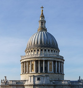
Experience the inside track on one of the world’s best known places of worship and visitor attractions.
National Audit Office (NAO) says Government building maintenance backlog is at least £49 billion

The public spending watchdog will need to consider the best way to manage its assets to bring property condition to a satisfactory level.
IHBC Publishes C182 focused on Heating and Ventilation
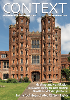
The latest issue of Context explores sustainable heating for listed buildings and more.
Notre-Dame Cathedral of Paris reopening: 7-8 December
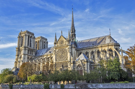
The reopening is in time for Christmas 2025.
Stirling Prize-winning Salford building to be demolished
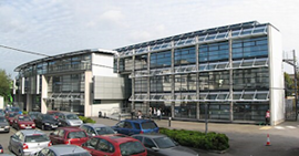
The Centenary Building will be bulldozed as part of the wider £2.5bn Crescent regeneration project.